When one is at the North Pole, whichever direction you look, it is south. There is no west, no east, or north. Only south. There is no land, and the pack ice is omnipresent, even if global warming today reveals more and more stretches of open water here and there. There is no assigned time zone, only one day and one night in the year, each of them lasting six months. The sun rises above the horizon on March 21 and does not set until September 21. The polar night then plunges the pack ice into freezing darkness until the following spring.
This hostile environment is home to no visible flora or fauna. Neither polar bear nor walrus, not even a flapping wing. The mammals of the Arctic do not venture this far north. The pack ice remains a great white desert. Under the ice, only planktonic life populates the ocean.
The Discovery of the Pole
The Earth’s poles have always fascinated and inspired people. Their conquest remains an adventure and an example of human resilience. Expeditions heavy in equipment and human resources have followed one another over the last century. While the discovery of the South Pole is clearly attributed to the Norwegian Roald Amundsen on January 14, 1911, that of the North Pole remains uncertain. In 1909, the American Robert Peary claimed to have reached the pole on April 6. But another American explorer, Frederick Cook, claims to have reached it a year earlier, in April 1908. Neither of them being able to prove their feat, the timeline remains controversial.
In 1926 the Norwegian Roald Amundsen flew over the North Pole in an airship. In 1938 the Russians established the first drifting base. The first concrete proof of a man reaching the North Pole was provided by the American Ralph Plaisted on April 19, 1968. The first man to reach the North Pole alone, without assistance, was the French doctor Jean-Louis Etienne, in 1986.
The North Pole Today
In 2006, Jean-Louis Etienne set up a scientific expedition whose goal was to measure the thickness of the pack ice. Using a device hung under an airship that would drift above the ice from east to west, passing through the pole, the expedition assessed the evolution of global warming. Knowing Jean-Louis Etienne from my experiences participating in a previous expedition with him on the atoll of Clipperton, he naturally called on me to join this expedition to the North Pole.
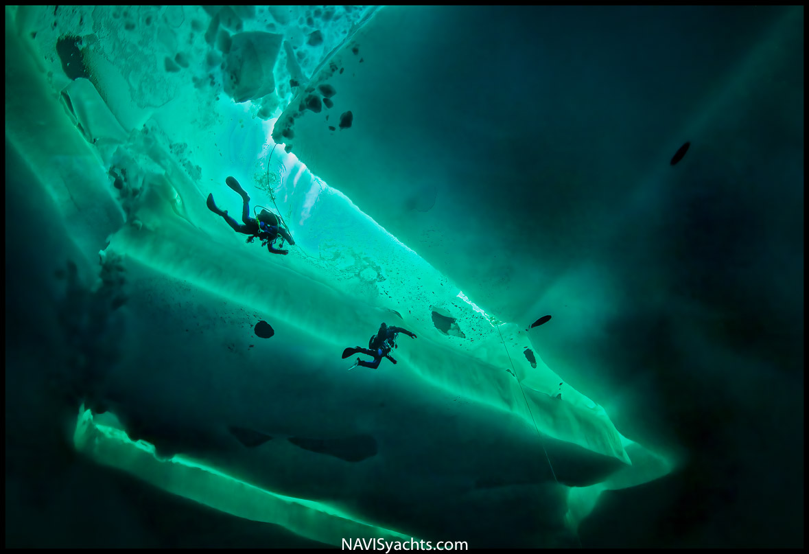
In preparation for the trip, our work was to carry out beforehand a 3D underwater map. Over a distance of a few hundred meters, the task was to verify that the information collected by the aerial measurement system corresponded to the information collected by the underwater images along this control distance.
In order to complete our tasks, we calibrated the measuring device to ensure the measurements taken by the helicopter confirmed the reality of the landscape. Mapping the underice formations in 3D imagery revealed the exact relief and thickness of the ice. Selecting a precise distance within a couple hundred meters marked on GPS points, the helicopter surveyed the same track using the same points. Comparison of the underwater and aerial readings served to validate the accuracy of the helicopter-borne system.
The logistics at the North pole were provided by the Russians at the Barneo camp, a polar station made up of tents set up from mid-March to May 1st. Barneo was created in 2002 to welcome scientists from different countries who wanted to make surveys, mainly focused on climate change.
Then, Barneo began to welcome wealthy tourists who wanted to book a unique experience at the Pole by hiking or skiing, or even parachute jumping!


Photos: Stephane Compoint, Didier Noirot | Words: Didier Noirot


